Mongolia Travel Map
Mongolia travel map explained: the Gobi, Central Khangai, Khövsgöl in the north, the western Altai and the eastern steppe, with classic routes from Ulaanbaatar.
3 min read · Updated
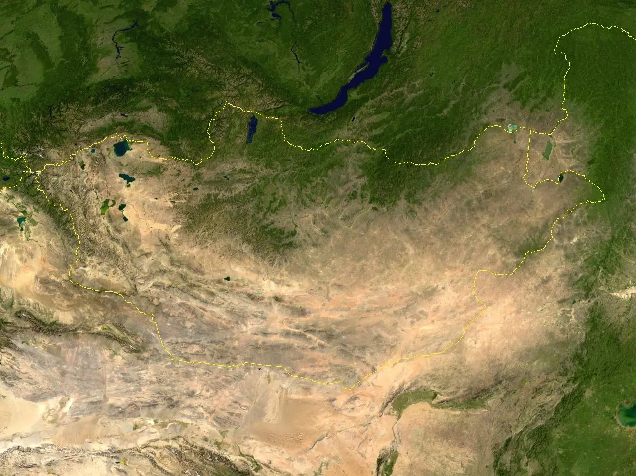
Photo: Unknown · Public domain · Wikimedia Commons
A Mongolia travel map is easiest to read as five regions: the Gobi in the south, the Central (Khangai) region, the North around Lake Khövsgöl, the West with the Altai Mountains, and the East with its open steppe. Ulaanbaatar sits in the north-centre of the country and is the starting point for almost every route.
The five main travel regions
Gobi (south)
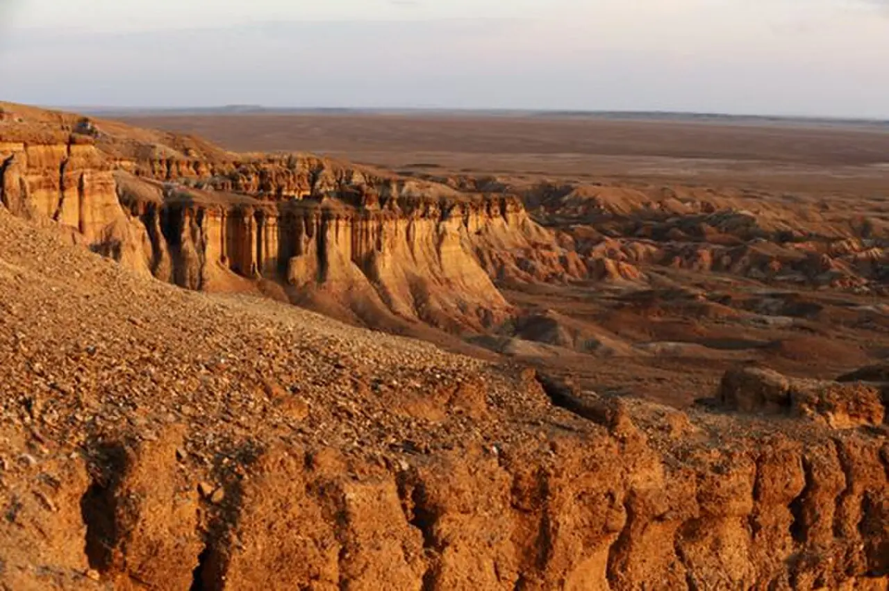
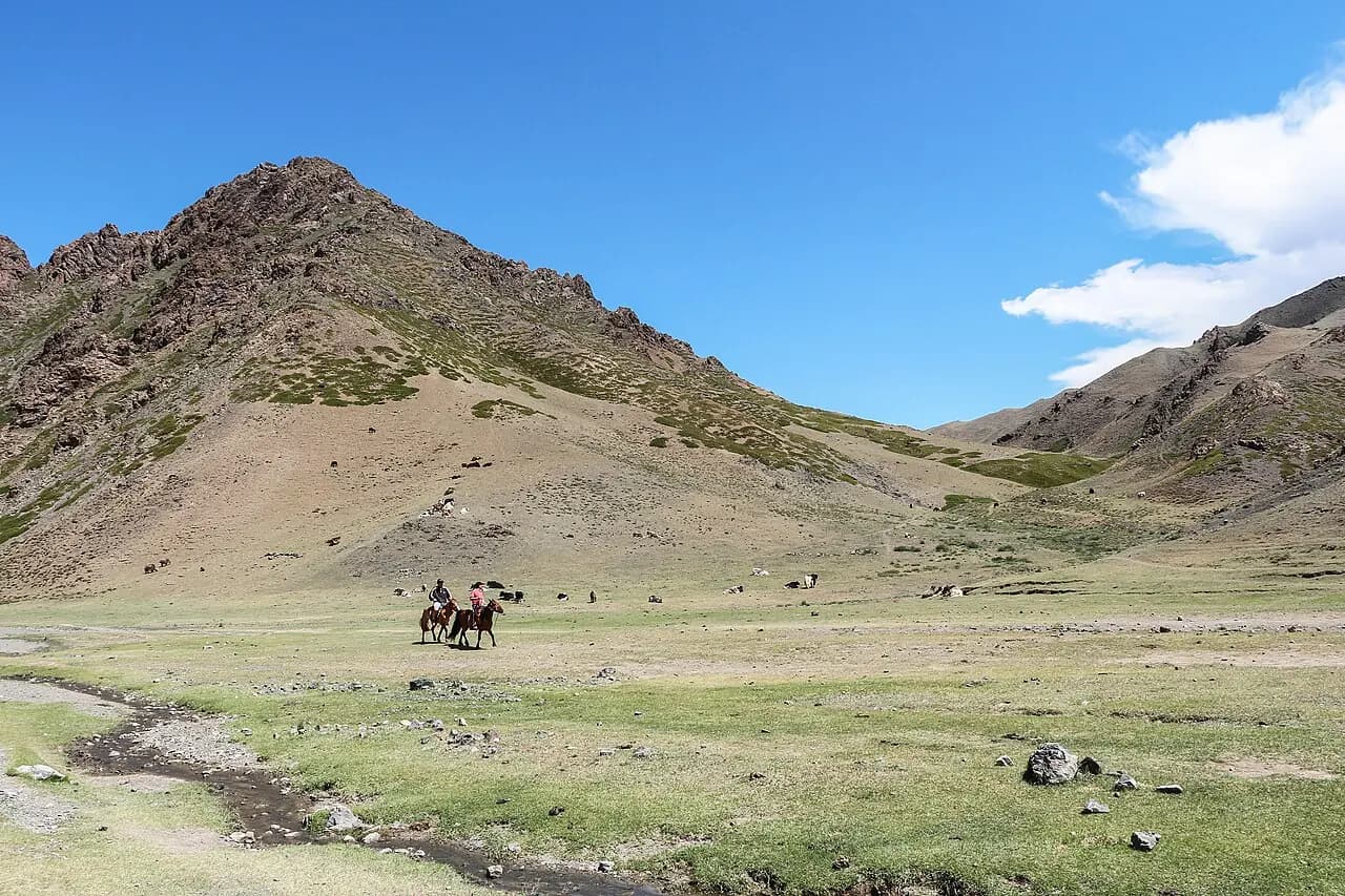
A semi-desert of gravel plains, rocky cliffs and sand dunes, centred on Ömnögovi and Dundgovi provinces. The highlights are Tsagaan Suvarga, Yolyn Am in Gobi Gurvansaikhan National Park, the Khongoryn Els dunes and Bayanzag (the Flaming Cliffs). Dalanzadgad is the regional hub, with an airport.
Central Mongolia (Khangai)
Övörkhangai, Arkhangai and Töv provinces: Kharkhorin and Erdene Zuu Monastery, the Orkhon Valley cultural landscape (a UNESCO World Heritage site), Terkhiin Tsagaan Lake and the extinct Khorgo volcano, Khögnö Khan mountain and the Elsen Tasarkhai dunes, Khustai National Park with its Przewalski's horses, and Gorkhi-Terelj National Park near Ulaanbaatar. This is the region of green valleys, rivers and the most visible nomadic life.
North (Khövsgöl)
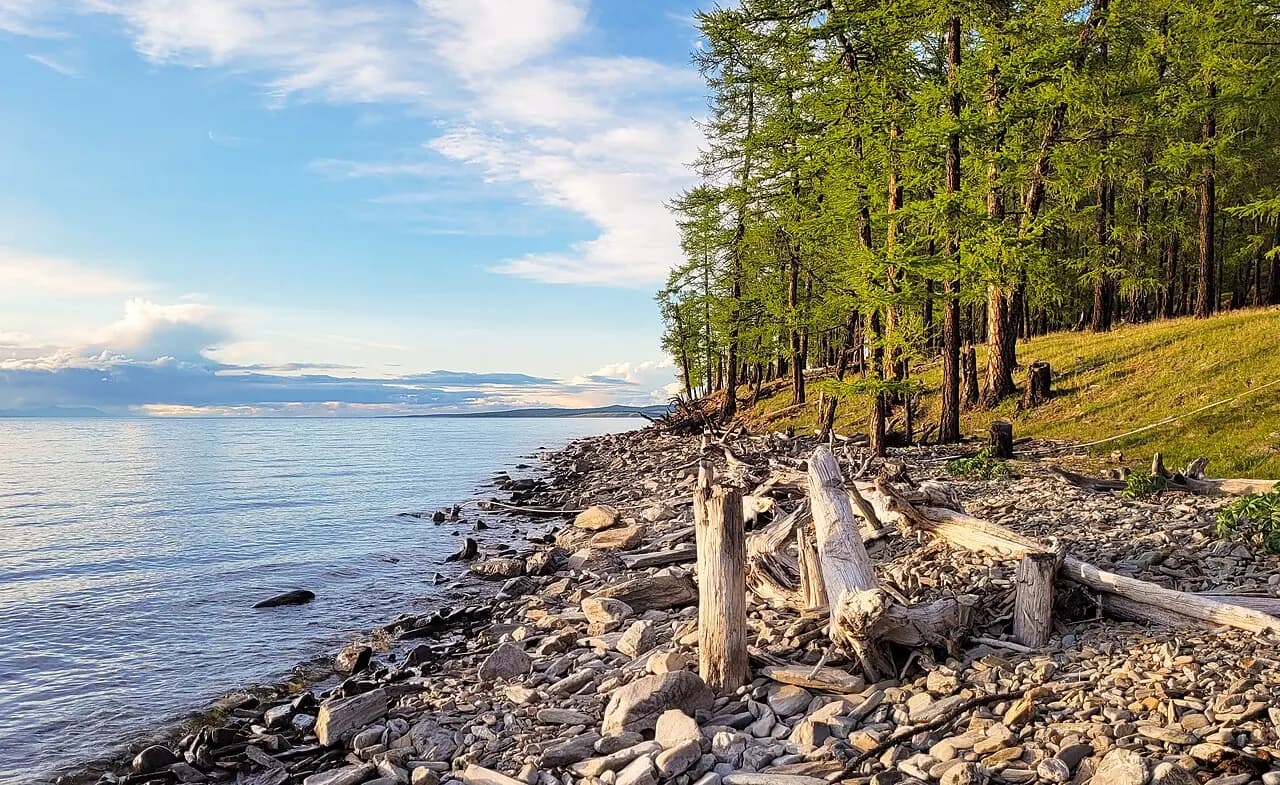
Lake Khövsgöl is a deep, clear lake that holds around 70% of Mongolia's fresh water. Mörön is the hub with an airport, and Khatgal village sits at the lake's southern tip. In the far northern taiga, Tsaatan (Dukha) families herd reindeer. Amarbayasgalant Monastery lies in nearby Selenge province.
West (Altai)
Bayan-Ölgii, Khovd and Uvs provinces: Altai Tavan Bogd National Park with Khüiten Peak (4,374 m), Mongolia's highest point; Kazakh eagle hunters and the Golden Eagle Festival in early October; Uvs Nuur, Mongolia's largest lake by area; and Khyargas Nuur. The region is reached by domestic flights to Ölgii, Khovd or Ulaangom, or by a very long drive.
East
Khentii, Dornod and Sükhbaatar provinces: the homeland of Chinggis Khaan, including Deluun Boldog, one of the places proposed as his birthplace; the Menengiin Tal steppe with its Mongolian gazelle herds; and Buir Nuur. Few tourists come here, and the landscapes are vast and open. Choibalsan is the regional hub.
Classic routes
- Gobi loop: 6–8 days from Ulaanbaatar (see the Gobi Desert tour map).
- Central loop: 5–8 days — Khustai or Khögnö Khan, Kharkhorin, the Orkhon Valley, Tsenkher hot springs, Terkhiin Tsagaan Lake.
- Gobi and Central combined: 10–14 days.
- Khövsgöl: fly to Mörön and drive to Khatgal, or drive about two days via Amarbayasgalant or through Central Mongolia.
- Western Altai: fly to Ölgii, then 5–10 days in the region.
- Eastern steppe: 5–8 days through Khentii to Dornod.
- Short trips: 1–3 days to Terelj, the Chinggis Khaan Equestrian Statue at Tsonjin Boldog, or Khustai.
Approximate distances from Ulaanbaatar
- Gorkhi-Terelj: about 60 km
- Kharkhorin: about 360 km, paved
- Dalanzadgad: about 550 km
- Mörön: about 670 km
- Choibalsan: about 650 km
- Ölgii: more than 1,600 km
Distances and driving times vary with the route and road conditions.
Practical tips
- Avoid squeezing too many regions into one trip; in two weeks, one or two regions can be seen comfortably.
- Match the region to the season: the Gobi and Central Mongolia from May to September, Khövsgöl from June to September, the Khövsgöl Ice Festival in March and the Golden Eagle Festival in October.
- Domestic flight schedules and road conditions change, so confirm with your tour operator and the airline.
- Download offline maps; mobile coverage can disappear for hours in the countryside.
Places in this guide
Lake Khövsgöl
The 'blue pearl of Mongolia', holding almost 70% of Mongolia's fresh water.
Tsagaan Suvarga
A 60 m wall of multicoloured clay, once a sea floor.
Yolyn Am
An ice-filled gorge in the heart of the Gobi; the ice survives into midsummer.
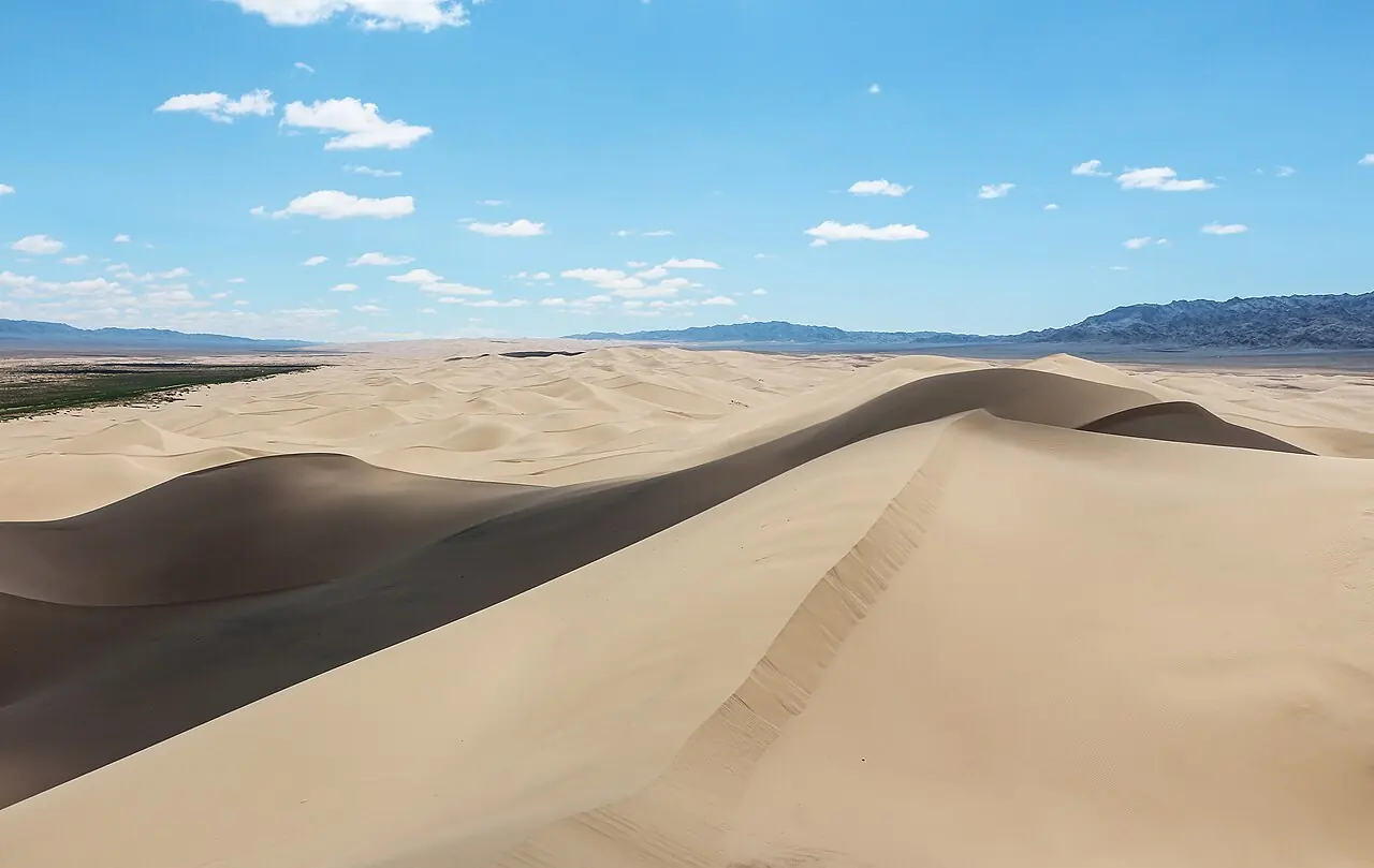
Khongoryn Els
The 'singing sands': one of Mongolia's largest dune fields, with ridges said to reach 300 m.
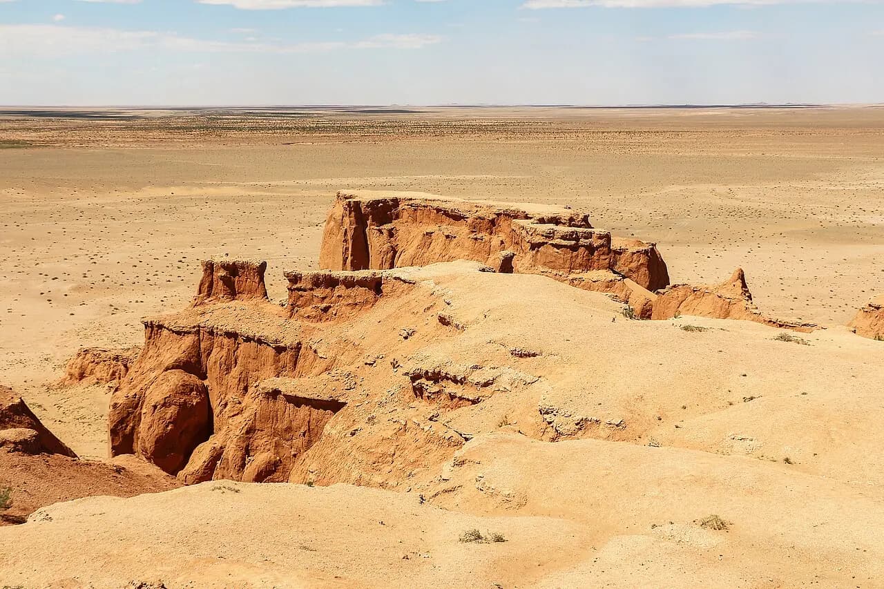
Bayanzag (Flaming Cliffs)
The red cliffs where dinosaur eggs were first discovered.
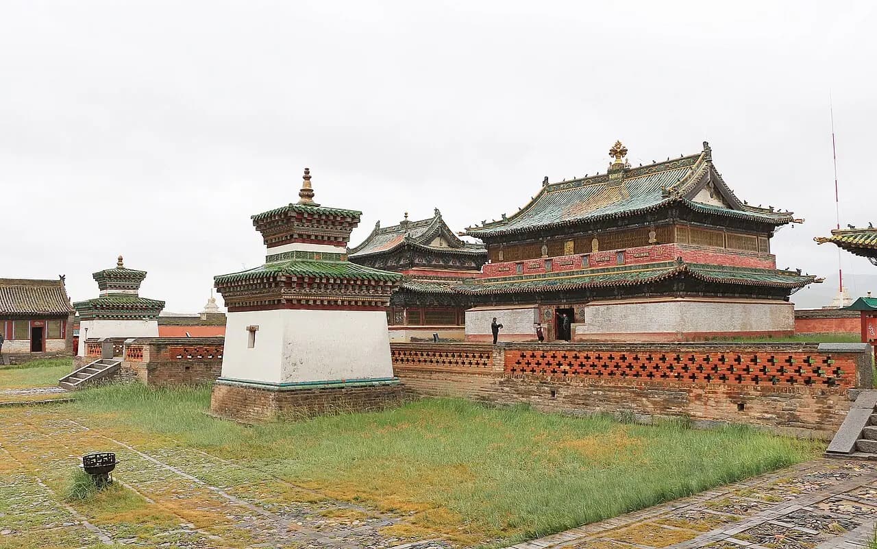
Kharkhorin & Erdene Zuu
Mongolia's oldest surviving Buddhist monastery, built on the ruins of the imperial capital Karakorum.
Frequently asked questions
Which region of Mongolia is best for a first trip?
Most first-time visitors combine the Gobi and Central Mongolia; in 10–14 days you see dunes, monasteries, green valleys and nomadic life.
How far is Lake Khövsgöl from Ulaanbaatar?
Mörön is about 670 km away and Khatgal roughly 100 km further. Most people drive in two days or fly to Mörön.