Mongolia on the World Map
Where is Mongolia on the world map? A landlocked country between Russia and China: borders, latitude and longitude, size and comparisons with other countries.
3 min read · Updated
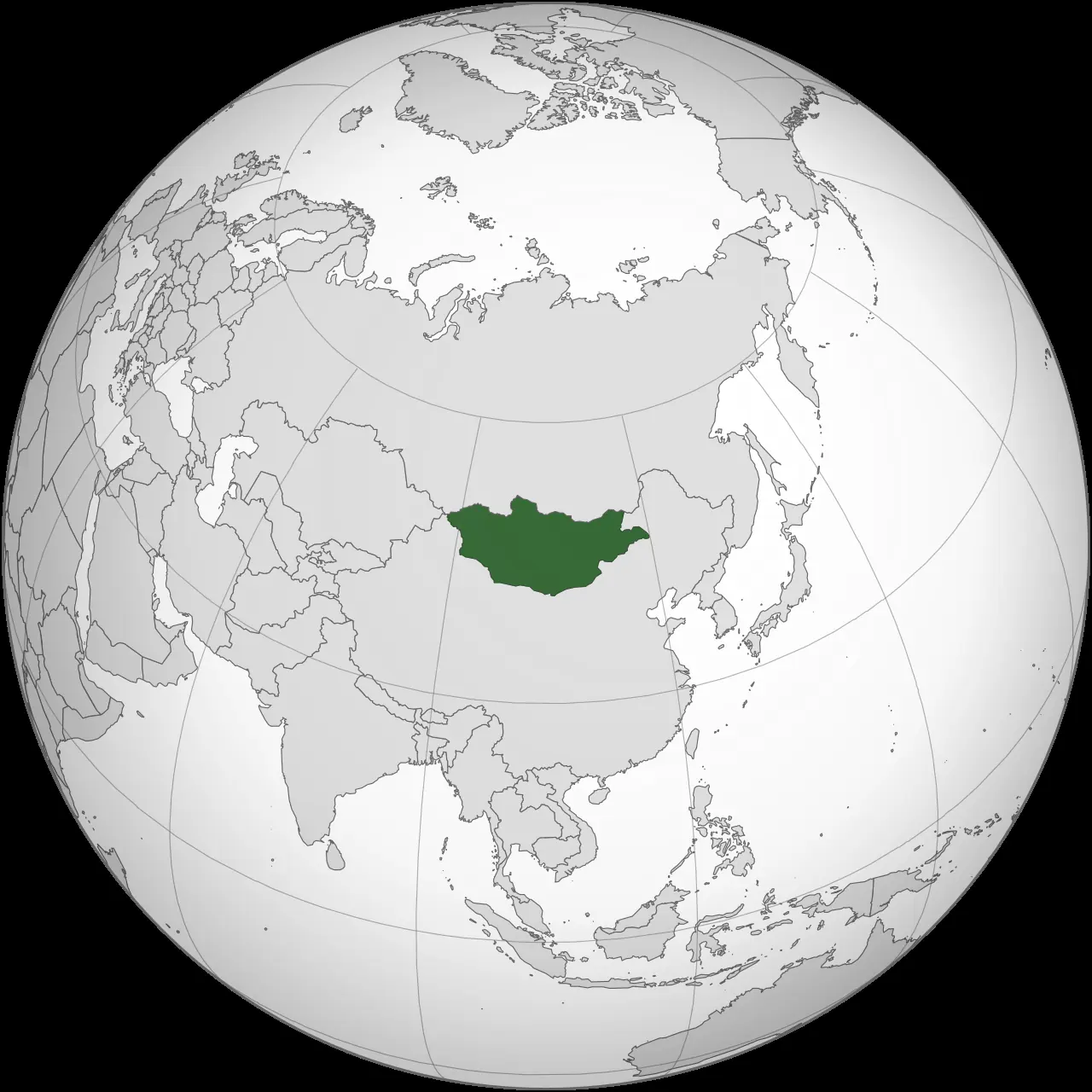
Photo: ASDFGHJ · CC BY-SA 3.0 · Wikimedia Commons
Mongolia lies in East and Central Asia, a landlocked country between Russia to the north and China to the south. It covers about 1.56 million km², stretches roughly from latitude 41.5° to 52° north and longitude 87.7° to 120° east, and is the world's second-largest landlocked country after Kazakhstan.
Where Mongolia is on the world map
On a world map, look north of China and south of Siberia. Mongolia sits on a high plateau in the heart of Asia, far from any sea: the nearest coastline is several hundred kilometres away across China. Its average elevation is about 1,580 m above sea level, making it one of the highest countries in the world. The capital, Ulaanbaatar, lies at roughly 47.9° N, 106.9° E — a similar latitude to Vienna or Seattle — and is often described as the world's coldest capital by average annual temperature.
Borders with Russia and China
Mongolia has only two neighbours.
- Russia: the northern border is about 3,500 km long and touches the Altai Republic, Tuva, Buryatia and Zabaykalsky Krai.
- China: the southern and eastern border is about 4,600 km long, mostly with Inner Mongolia, plus Xinjiang in the west and a short section with Gansu.
- Kazakhstan: in the far west, Mongolia comes within 40 km of Kazakhstan, but the two countries do not share a border.
The main border crossings are Altanbulag–Kyakhta (road) and Sükhbaatar–Naushki (rail) to the north, and Zamyn-Üüd–Erenhot (road and rail) to the south. Opening hours and which crossings are open to foreigners can change, so confirm with the Mongolian border authorities and the Immigration Agency of Mongolia before planning an overland route.
Size comparisons
- About 1,564,000 km², roughly 2,400 km from east to west and 1,260 km from north to south.
- Nearly three times the size of metropolitan France, more than four times Germany, slightly smaller than the US state of Alaska and more than twice the size of Texas.
- Population about 3.5 million (2024), around 2 people per km², one of the lowest population densities of any country. Nearly half of all Mongolians live in Ulaanbaatar.
Latitude, longitude and landscapes
The northernmost point is at about 52° N (Khövsgöl province), the southernmost at about 41.6° N (Ömnögovi), the westernmost at about 87.7° E (Bayan-Ölgii) and the easternmost at about 120° E (Dornod). Because of this east–west spread, most of the country is on UTC+8 while the western provinces use UTC+7. The Altai Mountains rise in the west, the Khangai range in the centre and the Khentii range in the north-east; the Gobi covers the south, open steppe dominates the east, and Siberian taiga reaches into the far north. The highest point is Khüiten Peak (4,374 m) in the Altai Tavan Bogd massif; the lowest is the Khökh Nuur depression in Dornod province in the east, at about 560 m.
Practical tips
- Do not confuse Mongolia with Inner Mongolia, which is a region of China; they are separate areas on the map.
- Distances look short on a world map, but many routes are unpaved, so plan travel times generously.
- Transliterations vary (Ulaanbaatar, Ulan Bator), so search for both spellings in offline map apps.
- A physical (relief) map is much more useful than a political map for route planning, as it shows the mountain ranges and the Gobi.
Places in this guide
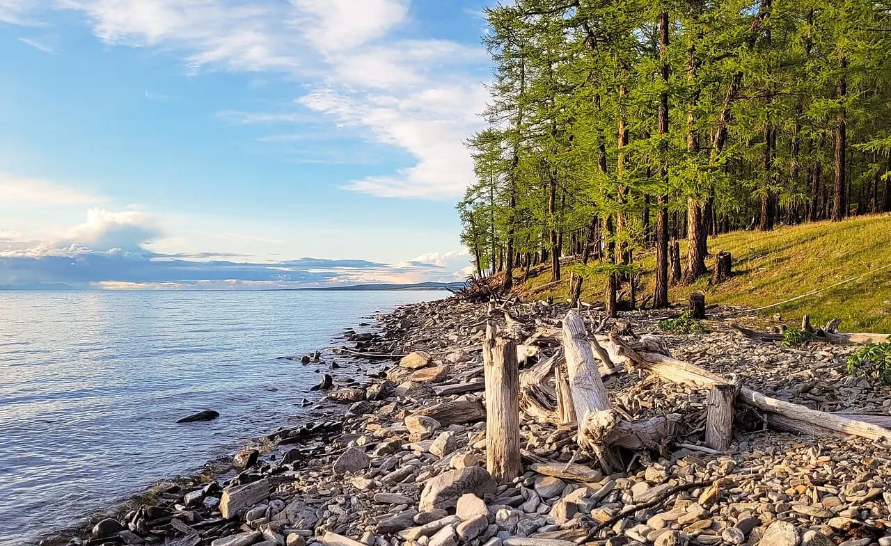
Lake Khövsgöl
The 'blue pearl of Mongolia', holding almost 70% of Mongolia's fresh water.
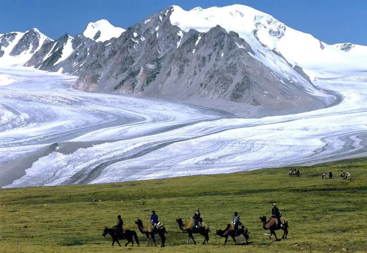
Altai Tavan Bogd
Mongolia's highest peak Khüiten (4,374 m) and the Potanin glacier.
Frequently asked questions
How many countries border Mongolia?
Two: Russia to the north and China to the south and east.
Does Mongolia have a coastline?
No. Mongolia is landlocked and is the second-largest landlocked country in the world after Kazakhstan.
How big is Mongolia?
About 1.56 million km² — nearly three times metropolitan France and more than four times the size of Germany.